How drone technology works
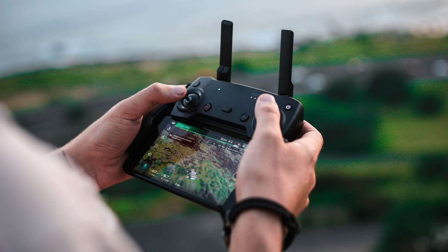
To gain a better understanding of drones use in agriculture, let’s take a closer look at drone technology. Typically, a drone construction includes propulsion and navigation systems, GPS, sensors and cameras, programmable controllers as well as equipment for automated flights.
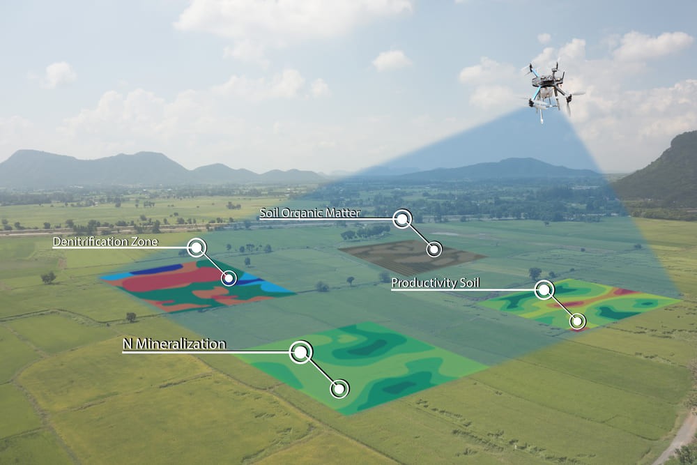
The technology used for UAV drones for agriculture are built in a way that enables them to capture more accurate information than airplanes and satellites are capable of collecting. Drone-based aggrotech software processes the collected data and delivers it in an easy-to-read format.
All in all, the data collection process in the case of agriculture drones includes four logical steps:
1. Indicating flight parameters: Outlining and evaluating the surveillance area and uploading GPS info into the drone navigation system.
2. Autonomous flights: A UAV drone carries out a flight pattern according to the pre-established parameters and collects the required data.
3. Data upload: The drone submits the data it has captured for processing and analysis.
4. Information output: After the data has been processed, it is sent to farmers in a readable format. The report contains insightful info which accounts for better farm management decisions.

Drone best practices in agriculture
The use of drones for precision agriculture is gaining momentum because of their capability to deliver the most up-to-date info fast and efficiently. The evolution of drone software and its overall affordability also account for the increased application of drones. Let’s now explore how drones can be used for agriculture, more specifically.
Estimating soil condition
Smart farming is data-driven, enabling farmers to take action based on accurate information on soil conditions. Extracting this data had previously involved physical visits to the field and gathering metrics manually. Equipped with agriculture smart sensors, drones can collect and deliver this data – needless to say, they can also do it in a faster and more precise manner.
Planting future crops
The soil gets prepared for planting and a drone shoots seeds in it, rather than using outdated planting techniques. Using drones for seed planting is relatively new, yet, some companies are experimenting with this approach.
For example, Drone Seed is a startup that uses drone technology for crop planting – and more. Unmanned aircrafts can also spray fields with water, fertilizers or herbicides, reducing costs, manual labor and time spent on these processes.
Fighting infections and pests
Not only can agriculture drones inform farmers on soil conditions using thermal, multispectral and hyperspectral technology, they can also detect field areas inflicted by weeds, infections and pests. Based on this data, farmers can decide on the exact amounts of chemicals needed to fight infestations, and not only help reduce expenses, but also contribute to better field health.

Agriculture spraying
Smart farms also use drones for agriculture spraying, which helps limit human contact with fertilizers, pesticides and other harmful chemicals. Drones can handle this task faster and more efficiently than vehicles and airplanes; they are also a great alternative for farms that still use manual labor.
Drones are also irreplaceable when it comes to spot treatment. They can detect infected areas with sensors and cameras and work on them while leaving the healthy part of the field intact. This not only saves time and increases safety, but also helps reduce expenses.
Crop surveillance
Agricultural fields occupy large areas, and it’s often nearly impossible to estimate the overall state of crops. By using drones for agriculture mapping, farmers can stay updated on the health of plants in a particular area and indicate which field areas require attention.
To estimate the state of crops, drones inspect the field with infrared cameras and determine light absorption rates. Based on accurate, real-time info, farmers can take measures to improve the state of plants in any location.
Livestock monitoring
In livestock farming, drones can keep an eye on the cattle as it grazes on pastures, reducing the need for human workforce on horseback and trucks. Using thermal sensor technology, drones can find lost cattle, detect injured or sick animals, and calculate their exact numbers. Admittedly, drones are capable of doing a better cattle surveillance job than herding dogs.
Things to consider before developing drone solutions in agriculture
Drones are accessible and relatively inexpensive, yet there are important things to take into account before implementing drone solutions. The steps involved in transforming your farm into a drone-enhanced agritech business include the 5 following aspects:
1. Determining goals
Agriculture drones have a range of applications: field and crop monitoring, seed planting, cattle surveillance, etc. What do you want them to do? Determine the core farm processes that you believe would benefit most from using drones.
2. Studying the legislation
Better yet, hire a lawyer to take care of all legal aspects involved in commercial drone usage. These will vary depending on your country or state of residence. Register your drone if you have to and find out which types of drones you can legally use in your area. Also, carefully study security instructions on flying your drone, since you will be held accountable in case of accidents.
3. Deciding on the drone hardware
Based on the tasks you want to accomplish, it is necessary to decide which hardware to equip your drone with. For example, for crop health monitoring, your drone will need an infrared camera. If you want it to estimate soil condition, it will need appropriate sensors, etc. In a nutshell, your drone capabilities will depend on the tasks you have in mind.

4. Selecting the type of drone software
The data your drone collects will have to be processed with agriculture drone software. You will most likely need navigation and flight management software, mapping, as well as data and image processing software, depending on your drone type. In some cases, ready-made, out-of-the-box software won’t work and you will need custom-made solutions.
5. Developing custom-made drone software
At the initial stage, this will require an understanding of the data collection, analysis, and visualization process. Further on, you will need in-depth knowledge of plant physiology to instruct the software algorithms to recognize certain patterns indicating plant conditions (the same goes for soil conditions or cattle behavior patterns for livestock farms).
You will also have to decide on the optimal image processing type, and on how your drone data will correlate with other metrics – like humidity, temperature, field topography, etc.
Final thoughts
Agricultural drone technology has the potential to transform modern farming in a number of ways. To fully benefit from it, though, farmers have to go through a careful preparation process – from estimating business goals, to deciding on the proper hardware stack and drone software features.
All in all, agricultural drone technology development is a complex task that will require partnering with a reliable third-party drone hardware and software solutions provider.

Comments
Post a Comment